
SRMC has provided aerial photography and mapping services since 1974.
Contact us for:
Contact us for:
- Aerial Photography
- Digital Orthophotos
- Terrain Modeling
- Topographic Maps
- LiDAR
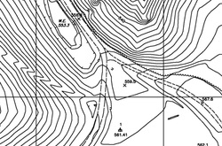
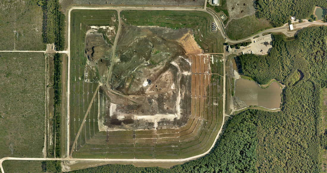
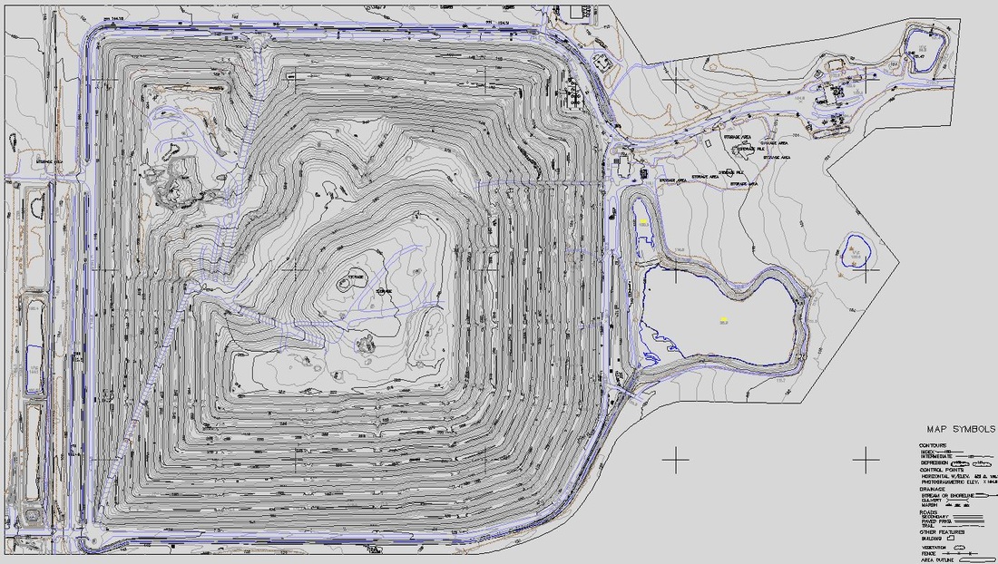
SRMC has provided full-service mapping solutions since 1974. We fly our own planes and digital cameras and we compile all mapping data right in our Alabama office. We primarily work in the southeastern US but serve clients scattered across the country. We specialize in engineering-quality topographic solutions for city streets, golf courses, pipelines, mines, landfills, stockpiles and everything in between. We also provide custom color, color infrared and 4-band aerial imagery as well as digital orthophotos to suit any need. Contact us today for a proposal. mailto:david@srmcmaps.com
Testimonials:
We have been using SRMC for about 20 years now for our annual aerial surveys and photo work. The quality of their work is always excellent and the price is reasonable. The people at SRMC are what really make the difference. They always make sure that I get exactly what I need.
Dan Ball, PE, Gulf Coast
Area Engineering Manager – Waste Management, Inc.
We have used SRMC for over 25 years because they provide accurate volumetric results in a timely manner with flexible scheduling that allows us to verify monthly coal inventory at multiple sites, they provide high-quality aerial photos in a variety of sizes to monitor projects or be used in management presentations, and their staff is professional and easy to work with.
Larry Thornton
Walter Energy, Inc.
SRMC has been providing aerial services for the Southeast Division of Martin Marietta Materials for many years. They have been very consistent in providing an accurate and reliable product that we use for all our mine planning needs. We can always depend on SRMC on fulfilling their obligations concerning schedule and budget.
Brad McDanal, Southeast Division
Martin-Marietta Materials, Inc.
quality.reliability.integrity